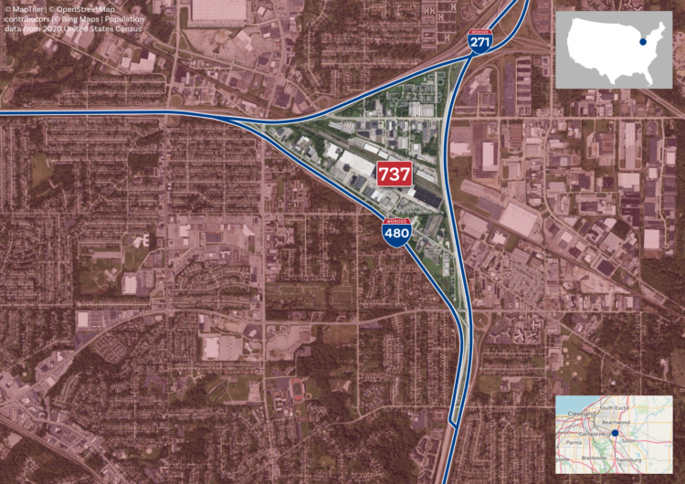
Filed under random but fun calculations, Alasdair Rae estimated the number of people within interstate boundaries:
I loaded up a MapTiler streets backdrop layer in QGIS, created polygons from the the US national road network file from the Department of Transportation website (this required a lot of error checking/fixing) and then summed the population of all areas bounded by Interstates – including those in Hawaii, Alaska and Puerto Rico.
Tags: Alasdair Rae, interstate, population