Peter Atwood used NASA data to depict the wildfires in Canada this year. The realistic rendering of the fires as burning embers and smoke activity is something.
Tags: Canada, Peter Atwood, wildfire
Adam's Blogroll: click through to the author's blog
Peter Atwood used NASA data to depict the wildfires in Canada this year. The realistic rendering of the fires as burning embers and smoke activity is something.
Tags: Canada, Peter Atwood, wildfire
Posted by in canada, maps, Peter Atwood, wildfire
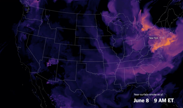
Wildfires in one area means smoke and pollution travels to surrounding areas, even thousands of miles away. For NYT’s The Upshot, Aatish Bhatia, Josh Katz, and Margot Sanger-Katz have the maps and charts that show how smoke traveled from the wildfires in Quebec, Canada.