Map of Lahaina buildings destroyed in wildfire

Most of the Maui town Lahaina was destroyed by wildfire. The Wall Street Journal reports. The map shows the buildings that were destroyed in red.

Terrible. Here is a list of reputable sources to donate to help people affected.

Tags: , , ,

Mapping all the buildings

A few months back, Microsoft released a comprehensive dataset that included the estimated footprints of all of the buildings in the United States. The New York Times mapped all of it.

The footnote says a lot about their attention to detail:

In some cases, the building shapes generated by Microsoft’s automated process do not match the existing building footprints exactly. We manually corrected as many of these mistakes as we found, or, where available, replaced the shapes using more precise local data sets. Data was unavailable for much of Alaska.

Tags: ,

All the building footprints in the United States

Microsoft released a comprehensive dataset for computer-generated building footprints in the United States. The method:

We developed a method that approximates the prediction pixels into polygons making decisions based on the whole prediction feature space. This is very different from standard approaches, e.g. Douglas-Pecker algorithm, which are greedy in nature. The method tries to impose some of a priory building properties, which are, at the moment, manually defined and automatically tuned.

The GeoJSON files for each state are available for download, released under the Open Data Commons Open Database License. Nice.

Tags: ,

All the buildings in Manhattan in 3-D map

Taylor Baldwin mapped all of the buildings in Manhattan using a 3-D layout. Rotate, zoom, and pan, and be sure to mess around with the parameters in the control panel for different looks. Also make sure you try it in Chrome, because it’ll probably send your computer fan whirling.

Tags: , ,

City layouts in 3-D

Manhattan

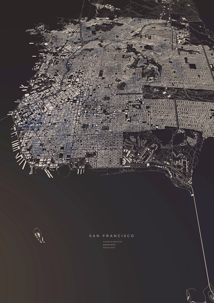
Luis Dilger made a set of fine-looking prints that show city landscapes in 3-D. They look like little cardboard cutouts.

I didn't only want to show these structures in the conventional way from above, but also including the exact three-dimensionality of topography and buildings - a real world visualisation.

The OpenStreetMap data enabled me to visualize the satellite-based information using DEM Earth in Cinema 4D. The results are some extraordinary views of large capitals and small towns.

Other cities include Copenhagen, Hamburg, Berlin, Paris, and others. Here's the one for San Francisco:

San Francisco

Get yourself a copy.

Tags: , ,