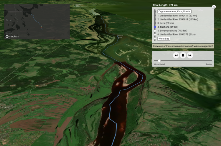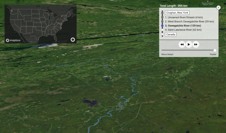
River Runner is a fun interactive map by Sam Learner. Click anywhere in the contiguous United States to drop some rain and, based on data from the U.S. Geological Survey, the map shows you where the rain ends up and the path it takes to get there.
This uses USGS NHDPlus data and their NLDI API to visualize the path of a rain droplet from any point in the contiguous United States to its end point (usually the ocean, sometimes the Great Lakes, Canada/Mexico, or another inland water feature). It’ll find the closest river/stream flowline coordinate to a click/search and then animate along that flowline’s downstream path.
When you think about it, it’s kind of nutty that something like this is even possible. [via Waxy]
Tags: rain, Sam Learner, water