Find a safe bike route with this map

Spring is in the air in a lot of places, and that means it’s time to dig up the bicycle from winter hibernation and have a ride. Not much beats the satisfaction of a casual ride in perfect weather. A gentle breeze kisses your face. The sun shines on you but it’s not too hot.

But then you realize you’re on a road without a bike lane and there’s heavy traffic. A semi truck rushes past you and you feel the weight of air almost blow you off your bike. Shoot. If only there was a map that you looked at beforehand that showed you the safe places to ride.

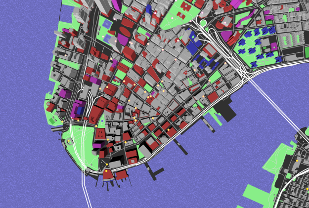
Oh wait, there’s this bike riding map from Mapzen that colors roads by three tiers of safety. Score.

Tags: ,

Tron-style slippy map

tron-style-slippy

Mapzen just released a Tron-style slippy map.

Today we introduce TRON version 2 as a fully realized Mapzen house style, rebuilt from the ground up to take advantage of the latest features of the Tangram graphics engine and Tangram blocks. With this new version, visual forms and elements transform per zoom, revealing new cartographic details and a deep exploration of scale transformations.

It’s slick. Be sure to zoom in.

Tags: ,

Posted by in maps, Mapzen, Tron

Tags: ,

Permalink

Send map tiles to 3-D printer

Tile exporter

Mapzen, which offers a vector tile service, made Tile Exporter, so that you can search the world and 3-D print your favorites.

Since the vector tiles contain three-dimensional information, I decided to fabricate them with a 3D printer. To prepare the tiles for the printer, we first created a tool called the Tile Exporter. It grabs a Mapzen vector tile, offers you 3d preview in your browser, and then creates an .OBJ file of the scene that you can download.

It’s super easy to use, and even if you don’t have access to a 3-D printer, it’s kind of fun to zoom in on locations and drag your mouse around. But, if you do have access to a 3-D printer, it’s even more fun.

I downloaded a quick file of the Empire State Building, and it was off to the printer no problem:

Empire State 3-D print

Of course, this all depends on data availability. The tiles are based on OpenStreetMap data, so if nothing is entered for your area of interest, there won’t be anything to print.

Tags: , ,

Open source mapping lab

Tangram from Mapzen

Mapzen focuses on building open source mapping components for developers.

We design things that can be provided as a service, but don't have to be—tools that developers at any level can easily set up and use themselves. We don't want to lock users into proprietary platforms, relying on black boxes they can't take apart. That's why we work on individual components, modular building blocks that anyone can use for better maps. We build things so you can build things.

Relatively new (at least to me), the collection of projects so far makes me think it's worth keeping an eye on the work that comes from these folks. There's an open source geocoder, a 2-D and 3-D mapping engine, and a vector tile service, all on GitHub. Plus, check out this blueprint-style prototype:

Nice.

Tags: ,