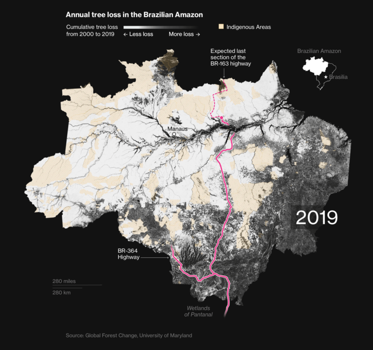
Bloomberg mapped tree loss between 2000 and 2019 in Brazil:
“What we have seen in Brazil is that rainforest protection is a highly political issue,” says Gerlein-Safdi of the University of Michigan. “With every change in government, laws can change very quickly, both for better or for worse.”
In some areas, the damage has been done. Efforts to build roads through the forest have opened up large swaths to exploitation. Satellite images of a new highway through the Amazon show how fast the land use changes from primary forest to agricultural land once logging companies and farmers gain access.
The maps are based on an analysis by University of Maryland geographers. The researchers compared satellite imagery over time to compare forest changes on a global scale, and you can download the data here.
Tags: Bloomberg, Brazil, rain forest